Day 29
St. Louis MO, 0 miles (Rest Day 1)
I’m putting today’s post up early. I don’t have a lot planned for today. Zero miles in fact. I’m going to clean the bike and get it ready to take in tomorrow for its’ new chain and cassette. I’m going to rest my legs and read as much about the Katy Trail as I can. For example, I know the trail is the longest “rail trail” project in the U.S. At 280 miles long, It takes its’ riders from St. Louis all the way to Kansas City. it is as long as the Colorado River. Unlike the river however, it is dry and mostly flat, unless it rains, then it becomes a mess to ride on, or so I’m told. Rain is in the forecast here for the day after I head out onto the trail, I suppose I’ll find out first-hand what that means for bike and rider.
I wanted to say a bit more about my crossing over the Chain or Rocks bridge. You can sense what an important structure it was back in its’ day. There is something majestic about the structure, nothing like today’s modern concrete bridges, it is actually quite dramatic to look at up close. It is also narrow, which is clearly shown in yesterday’s photo. It’s no wonder it was only in service from 1936 until 1965, less than three decades. What is amazing is that it is still standing today. The Army Corp of Engineers wanted to tear it down but the price of scrap steel at the time did not make the proposal feasible. That’s a good thing, because we now have preserved for our enjoyment an important part of our history. Hopefully future generations will be able to enjoy this early engineering marvel as well.
In the end we will conserve only what we love; we will love only what we understand; we will understand only what we are taught.”
— Baba Dioum, Senegalese Conservationist
During the last Ice Age, the Mississippi River was blocked by an ice dam and was forced to change its’ course. the new channel it carved exposed a layer of bedrock that the river has not yet been able to fully erode. The exposed layer of bedrock was up river from the bridge and referred to as the “Chain of Rocks.” To allow safe passage on the river, the Army Corp of Engineers built a low-water dam just below the bridge. You can see this clearly in the photo below. This raised the level of the river over the rocks enough to allow safe passage. In 1956 the Corp built and 8 mile long canal that shipping uses to bypass this stretch of river entirely. Also in the photo below, taken from the bridge, you can see a tower in the middle of the river. This was used from 1894 until 1915 to draw drinking water for St. Louis.
During the course of its’ 50 year history, Route 66 has crossed the Mississippi River between St. Louis MO and Madison IL over a total of five bridges. The Chain of Rocks bridge is the only one no long carrying vehicle or rail traffic.
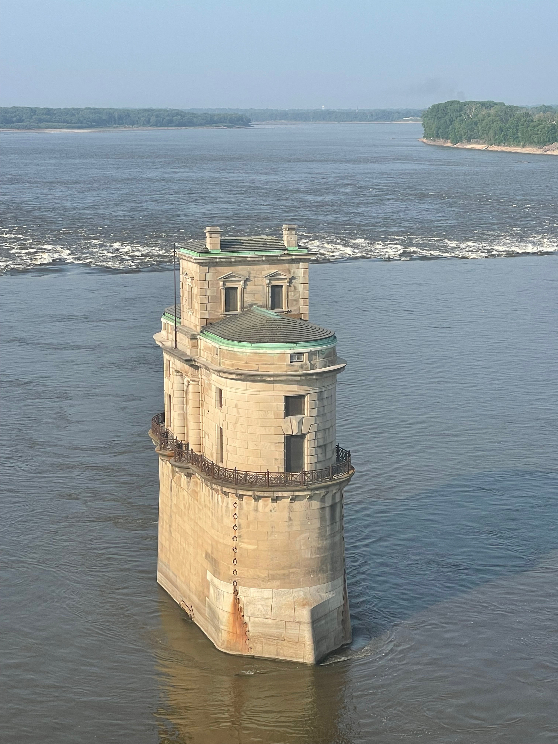
Tower and low-water dam just below the “Chain of Rocks” bridge.